
Huiyang District topographic map
Interactive map
Click on the map to display elevation.
About this map
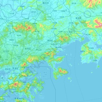
Name: Huiyang District topographic map, elevation, terrain.
Location: Huiyang District, Huizhou, Guangdong Province, China (22.25796 114.22423 23.13792 114.77074)
Average elevation: 69 m
Minimum elevation: -4 m
Maximum elevation: 1,259 m
Other topographic maps
Click on a map to view its topography, its elevation and its terrain.