
Ristiina topographic map
Interactive map
Click on the map to display elevation.
About this map
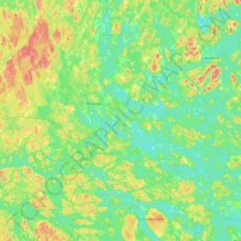
Name: Ristiina topographic map, elevation, terrain.
Average elevation: 97 m
Minimum elevation: 70 m
Maximum elevation: 179 m
Other topographic maps
Click on a map to view its topography, its elevation and its terrain.
Kalevankangas
Finland > South Savo > Mikkeli > Kalevankangas
Kalevankangas, Mikkeli, Mikkelin seutukunta, South Savo, Regional State Administrative Agency for Eastern Finland, Mainland Finland, 50100, Finland
Average elevation: 100 m