
姜家夼村 topographic map
Interactive map
Click on the map to display elevation.
About this map
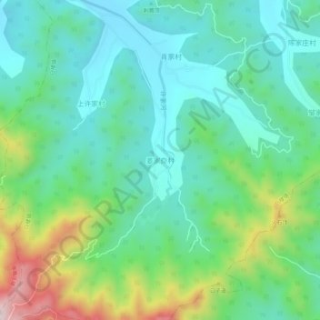
Name: 姜家夼村 topographic map, elevation, terrain.
Location: 姜家夼村, Yantai, Shandong, 264000, China (37.33759 121.22666 37.37759 121.26666)
Average elevation: 179 m
Minimum elevation: 36 m
Maximum elevation: 566 m