Geolocate

Forestbrook topographic map

Click on the map to display elevation.

About this map
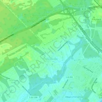
Name: Forestbrook topographic map, elevation, terrain.

Location: Forestbrook, Horry County, South Carolina, United States (33.70782 -78.99287 33.74093 -78.94362)

Average elevation: 7 m

Minimum elevation: 0 m

Maximum elevation: 13 m

Gear up for your next adventure:

🧢Hiking Hats - Sun and weather protection for outdoor walks
🛌Sleeping Mats - Insulated mats for comfortable outdoor sleeping
🗺️Topographic Maps - Detailed maps showing elevation and terrain features
🛌Sleeping Bags - Warm and packable sleeping bags for outdoor nights
🔦Waterproof LED Headlamps - Hands-free lighting for evening treks and emergency navigation

As an Amazon Associate, this site earns from qualifying purchases at no extra cost to you.