
Thank you for supporting this site ❤️
Make a donation
Make a donation
Gear up for your next adventure:
As an Amazon Associate, this site earns from qualifying purchases at no extra cost to you.
Kundal topographic map
Click on the map to display elevation.
Thank you for supporting this site ❤️
Make a donation
Make a donation
Gear up for your next adventure:
As an Amazon Associate, this site earns from qualifying purchases at no extra cost to you.
About this map
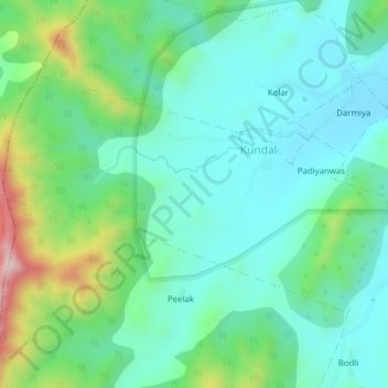
Name: Kundal topographic map, elevation, terrain.
Location: Kundal, Jhadol Tehsil, Udaipur District, Rajasthan, India (24.50093 73.28852 24.52253 73.32717)
Average elevation: 667 m
Minimum elevation: 557 m
Maximum elevation: 994 m
Thank you for supporting this site ❤️
Make a donation
Make a donation
Gear up for your next adventure:
As an Amazon Associate, this site earns from qualifying purchases at no extra cost to you.