
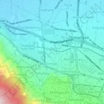
Çırpan Mahallesi topographic map
Interactive map
Click on the map to display elevation.
About this map
Name: Çırpan Mahallesi topographic map, elevation, terrain.
Average elevation: 193 m
Minimum elevation: 102 m
Maximum elevation: 589 m
Other topographic maps
Click on a map to view its topography, its elevation and its terrain.
Bursa
Turquía > Marmara Bölgesi > Bursa > Osmangazi
Bursa, Osmangazi, Bursa, Marmara Bölgesi, 16010, Turquía
Average elevation: 598 m