Geolocate

Point 5350 topographic map

Click on the map to display elevation.

About this map

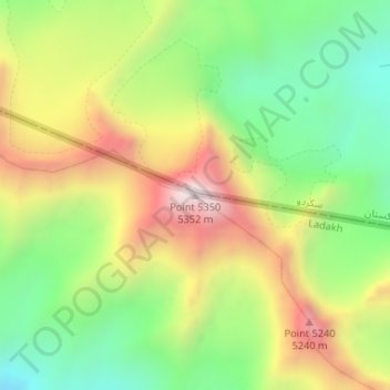
Name: Point 5350 topographic map, elevation, terrain.

Location: Point 5350, Kargil Tehsil, Kargil District, Ladakh, India (34.52562 75.69861 34.52572 75.69871)

Average elevation: 4,831 m

Minimum elevation: 4,438 m

Maximum elevation: 5,335 m

Other topographic maps

Click on a map to view its topography, its elevation and its terrain.

Marpola ridge

India > Ladakh > Kargil tehsil

Average elevation: 4,610 m

Gear up for your next adventure:

Lightweight Solo Tents - Backpacking tents designed for wild camping in the UK highlands
🍱Food Containers - Reusable containers for outdoor meals
🧼Camping Hygiene Kits - Compact hygiene essentials for outdoor stays
🧤Waterproof Overmitts - Extreme weather protection for hikers and mountaineers
👟Heavy Duty Boot Laces - Always carry a spare for your hiking footwear

As an Amazon Associate, this site earns from qualifying purchases at no extra cost to you.