Geolocate

Bhimashankar topographic map

Click on the map to display elevation.

About this map
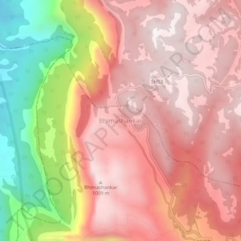
Name: Bhimashankar topographic map, elevation, terrain.

Location: Bhimashankar, Khed, Pune District, Maharashtra, India (19.05200 73.51576 19.09200 73.55576)

Average elevation: 749 m

Minimum elevation: 165 m

Maximum elevation: 1,047 m

Other topographic maps

Click on a map to view its topography, its elevation and its terrain.
Chaskaman

India > Maharashtra > Khed

Average elevation: 669 m

Gear up for your next adventure:

🪢Paracord - Multi-purpose cord for camping and survival
📸Action Camera Chest Mounts - Record your ascent following topographic paths hands-free
🧣Fleece Neck Warmers - Extra insulation for winter topographic surveys
🧦Merino Wool Hiking Socks - Moisture-wicking socks to prevent blisters during long mountain walks
📻Hand-Crank Emergency Radios - Stay updated on weather warnings in remote areas

As an Amazon Associate, this site earns from qualifying purchases at no extra cost to you.