
Glen Tanar topographic map
Interactive map
Click on the map to display elevation.
About this map
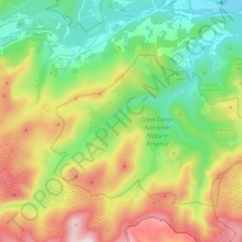
Name: Glen Tanar topographic map, elevation, terrain.
Average elevation: 389 m
Minimum elevation: 132 m
Maximum elevation: 821 m
Glen Tanar, along with the side glens formed by the Water of Gairney and the Water of Allachy, comprises the third largest area of Caledonian Forest in Scotland, which grows from the valley floor up to an altitude of 450 metres. As a Caledonian Forest, the predominant tree species is Scots pine, although broad-leaved tree species including birch, alder, rowan, holly, aspen and oak are also present. Juniper grows at the boundary between the forest and the open moorland above, and areas of blaeberry, heather and feather mosses can also be found. the woodland floor provides a habitat for many of the species typically found in the Caledonian Forest, including twinflower, creeping lady's-tresses, toothed wintergreen and intermediate wintergreen.