
Tateshina topographic map
Interactive map
Click on the map to display elevation.
About this map
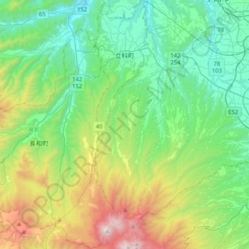
Name: Tateshina topographic map, elevation, terrain.
Average elevation: 1,062 m
Minimum elevation: 528 m
Maximum elevation: 2,525 m
Other topographic maps
Click on a map to view its topography, its elevation and its terrain.
Karuizawa
Karuizawa, Kitasaku County, Nagano Prefecture, Chubu Region, Japan
Average elevation: 1,117 m