
Jigme Dorji National Park topographic map
Interactive map
Click on the map to display elevation.
Jigme Dorji National Park
The Jigme Dorji National Park (JDNP), named after the late Jigme Dorji Wangchuck, is the second-largest National Park of Bhutan. It occupies almost the entire Gasa District, as well as the northern areas of Thimphu District, Paro District, Punakha, and Wangdue Phodrang Districts. It was established in 1974 and stretches over an area of 4316 km², thereby spanning all three climate zones of Bhutan, ranging in elevation from 1400 to over 7000 meters. About 6,500 people in 1,000 households live within the park, from subsistence agriculture and animal husbandry. It is listed as a tentative site in Bhutan's Tentative List for UNESCO inclusion.
About this map
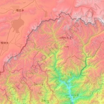
Name: Jigme Dorji National Park topographic map, elevation, terrain.
Average elevation: 4,173 m
Minimum elevation: 1,194 m
Maximum elevation: 7,291 m