
Make a donation
Gear up for your next adventure:
As an Amazon Associate, this site earns from qualifying purchases at no extra cost to you.
Cree River topographic map
Click on the map to display elevation.
Make a donation
Gear up for your next adventure:
As an Amazon Associate, this site earns from qualifying purchases at no extra cost to you.
About this map
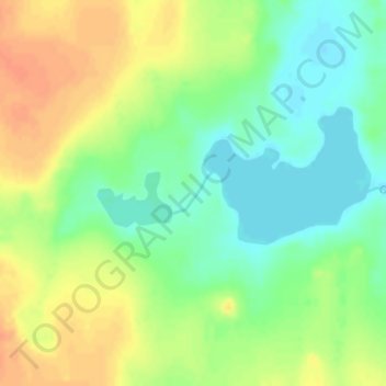
Name: Cree River topographic map, elevation, terrain.
Location: Cree River, ᕿᑎᕐᒥᐅᑦ Kitikmeot Region, Nunavut, Kanada (65.98955 -109.70104 65.99243 -109.69445)
Average elevation: 516 m
Minimum elevation: 500 m
Maximum elevation: 535 m
Make a donation
Gear up for your next adventure:
As an Amazon Associate, this site earns from qualifying purchases at no extra cost to you.
Other topographic maps
Click on a map to view its topography, its elevation and its terrain.
Canadian Forces Station Alert
Kanada > Nunavut > Region Qikiqtaaluk
Führende Offiziere der amerikanischen Luftwaffe trafen sich im September 2017 zum Teambuilding-Manöver „Uggianaqtuq“ in Alert, um das Verhalten unter Extrembedingungen zu üben und die Verbundenheit mit Kanada zu unterstreichen. Im August 2018 besuchte der kanadische Verteidigungsminister Harjit Sajjan…
Average elevation: 31 m
Make a donation
Gear up for your next adventure:
As an Amazon Associate, this site earns from qualifying purchases at no extra cost to you.
Make a donation
Gear up for your next adventure:
As an Amazon Associate, this site earns from qualifying purchases at no extra cost to you.