
Lac Français topographic map
Interactive map
Click on the map to display elevation.
About this map
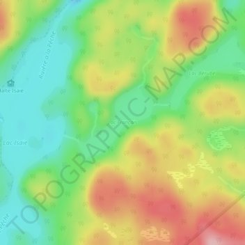
Name: Lac Français topographic map, elevation, terrain.
Location: Lac Français, Shawinigan, Mauricie, Quebec, Canada (46.71936 -72.83287 46.72712 -72.82071)
Average elevation: 230 m
Minimum elevation: 157 m
Maximum elevation: 325 m
Other topographic maps
Click on a map to view its topography, its elevation and its terrain.
Shawinigan
Canada > Quebec > Shawinigan
Shawinigan, Mauricie, Quebec, G9N 1H2, Canada
Average elevation: 139 m