
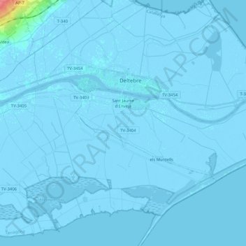
Sant Jaume d'Enveja topographic map
Interactive map
Click on the map to display elevation.
About this map
Name: Sant Jaume d'Enveja topographic map, elevation, terrain.
Average elevation: 0 m
Minimum elevation: -7 m
Maximum elevation: 61 m
Other topographic maps
Click on a map to view its topography, its elevation and its terrain.
la Galera
Spanien > Katalonien > Montsià > la Galera
la Galera, Montsià, Tarragona, Katalonien, 43515, Spanien
Average elevation: 134 m
Alcanar
Spanien > Katalonien > Montsià
Alcanar, Montsià, Tarragona, Katalonien, 43530, Spanien
Average elevation: 155 m