
Münster topographic map
Interactive map
Click on the map to display elevation.
About this map
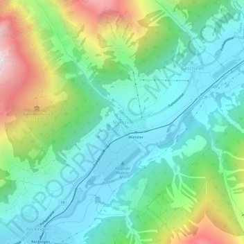
Name: Münster topographic map, elevation, terrain.
Location: Münster, Goms, Wallis, 3985, Schweiz (46.46707 8.24322 46.50707 8.28322)
Average elevation: 1,652 m
Minimum elevation: 1,311 m
Maximum elevation: 2,503 m
Das Dorf liegt auf einer Höhe von 1356 m ü. M. im obern Goms, am rechten Ufer der Rhone, hier Rotten genannt. Mitten durch das Dorf fliesst der Minstigerbach.