
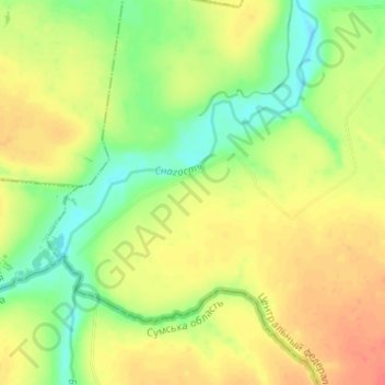
Николаево-Дарьино topographic map
Interactive map
Click on the map to display elevation.
About this map
Name: Николаево-Дарьино topographic map, elevation, terrain.
Average elevation: 175 m
Minimum elevation: 149 m
Maximum elevation: 200 m
Other topographic maps
Click on a map to view its topography, its elevation and its terrain.
Марьевка
Russia > Kursk Oblast > Sudzhansky District > Pogrebki
Марьевка, Pogrebki, Погребской сельсовет, Sudzhansky District, Kursk Oblast, Central Federal District, Russia
Average elevation: 193 m