
Lake Manchar topographic map
Interactive map
Click on the map to display elevation.
About this map
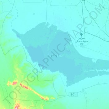
Name: Lake Manchar topographic map, elevation, terrain.
Location: Lake Manchar, Dādu District, Sindh, Pakistan (26.34941 67.53283 26.50270 67.81989)
Average elevation: 45 m
Minimum elevation: 30 m
Maximum elevation: 242 m
Other topographic maps
Click on a map to view its topography, its elevation and its terrain.
Gharo
Pakistan > Sindh > Dādu District
Gharo, Mehar Taluka, Dadu District, Hyderabad Division, Sindh, Pakistan
Average elevation: 47 m