
Les Vergiers topographic map
Interactive map
Click on the map to display elevation.
About this map
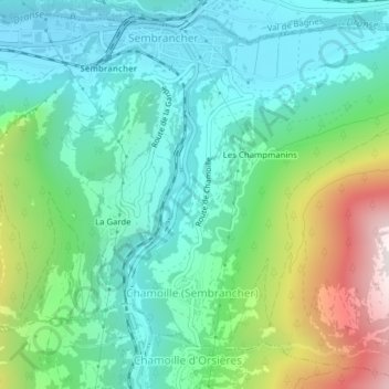
Name: Les Vergiers topographic map, elevation, terrain.
Location: Les Vergiers, Sembrancher, Entremont, Wallis, 2303, Schweiz (46.05756 7.14483 46.07756 7.16483)
Average elevation: 983 m
Minimum elevation: 694 m
Maximum elevation: 1,747 m