
Whangarei District topographic map
Interactive map
Click on the map to display elevation.
About this map
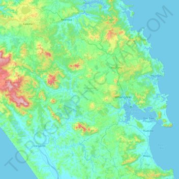
Name: Whangarei District topographic map, elevation, terrain.
Location: Whangarei District, Northland, Neuseeland (-36.08662 173.75009 -35.30172 174.59194)
Average elevation: 98 m
Minimum elevation: 0 m
Maximum elevation: 754 m