
González Catán topographic map
Interactive map
Click on the map to display elevation.
About this map
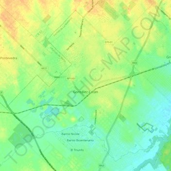
Name: González Catán topographic map, elevation, terrain.
Average elevation: 17 m
Minimum elevation: 4 m
Maximum elevation: 32 m
Other topographic maps
Click on a map to view its topography, its elevation and its terrain.
Barrio 17 de septiembre
Argentinien > Provinz Buenos Aires > González Catán
Barrio 17 de septiembre, González Catán, Partido de La Matanza, Provinz Buenos Aires, B1755, Argentinien
Average elevation: 21 m