
Dedham topographic map
Interactive map
Click on the map to display elevation.
About this map
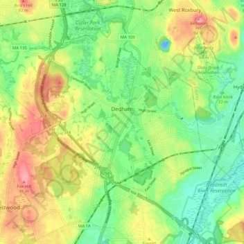
Name: Dedham topographic map, elevation, terrain.
Location: Dedham, Norfolk County, Massachusetts, United States (42.20922 -71.23172 42.28046 -71.13075)
Average elevation: 43 m
Minimum elevation: -24 m
Maximum elevation: 100 m
The first man-made canal in North America, Mother Brook, was created in Dedham in 1639. It linked the Charles River to the Neponset River. Although both are slow-moving rivers, they are at different elevations. The difference in elevation made the canal's current swift enough to power several local mills.
Other topographic maps
Click on a map to view its topography, its elevation and its terrain.
Ashcroft
United States > Massachusetts > Norfolk County > Dedham > Ashcroft
Ashcroft, Dedham, Norfolk County, Massachusetts, 02026-5036, United States
Average elevation: 30 m