Geolocate

Allende topographic map

Click on the map to display elevation.

About this map

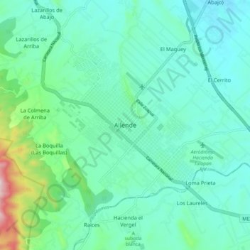
Name: Allende topographic map, elevation, terrain.

Location: Allende, Nuevo León, 67350, Mexico (25.24026 -100.05981 25.32026 -99.97981)

Average elevation: 466 m

Minimum elevation: 377 m

Maximum elevation: 854 m

Gear up for your next adventure:

🗺️Scratch-off Peak Maps - Track your progress climbing Munros or Wainwrights
🚶Walking Pedometers - Simple distance tracking for casual trail walkers
🔋Rechargeable Batteries - Eco-friendly power for headlamps and older GPS units
🔋Lithium AA Batteries - Long-lasting power that performs well in cold mountain weather
👟Women's Trail Running Shoes - Agile footwear for fell running and technical trails

As an Amazon Associate, this site earns from qualifying purchases at no extra cost to you.