
Bartolfelde topographic map
Interactive map
Click on the map to display elevation.
About this map
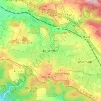
Name: Bartolfelde topographic map, elevation, terrain.
Average elevation: 329 m
Minimum elevation: 236 m
Maximum elevation: 431 m
Other topographic maps
Click on a map to view its topography, its elevation and its terrain.
Barbis
Deutschland > Niedersachsen > Landkreis Göttingen > Bad Lauterberg im Harz > Barbis
Barbis, Bad Lauterberg im Harz, Landkreis Göttingen, Niedersachsen, 37431, Deutschland
Average elevation: 312 m