
Lac Fleury topographic map
Interactive map
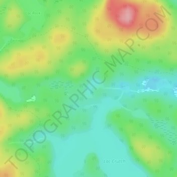
Click on the map to display elevation.
About this map
Name: Lac Fleury topographic map, elevation, terrain.
Average elevation: 355 m
Minimum elevation: 309 m
Maximum elevation: 435 m
Other topographic maps
Click on a map to view its topography, its elevation and its terrain.
Lac Rock
Canada > Québec > Pontiac (MRC) > Sheenboro
Lac Rock, Sheenboro, Pontiac (MRC), Outaouais, Québec, Canada
Average elevation: 364 m
Lac Barry
Canada > Québec > Pontiac (MRC) > Sheenboro
Lac Barry, Sheenboro, Pontiac (MRC), Outaouais, Québec, Canada
Average elevation: 318 m