Geolocate

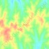
Coyle topographic map

Click on the map to display elevation.

About this map

Name: Coyle topographic map, elevation, terrain.

Location: Coyle, Logan County, Oklahoma, United States (35.94923 -97.24759 35.96029 -97.22920)

Average elevation: 273 m

Minimum elevation: 258 m

Maximum elevation: 309 m

Other topographic maps

Click on a map to view its topography, its elevation and its terrain.
Goodnight

United States > Oklahoma > Logan County

Average elevation: 271 m

Iconium

United States > Oklahoma > Logan County

Average elevation: 327 m

Gear up for your next adventure:

📍Handheld GPS Navigators - Reliable satellite navigation for hiking and off-road exploration
🕶️Glacier Goggles - Maximum protection for high-altitude snow topography
👟Waterproof Leg Gaiters - Keep mud and water out of your boots in boggy terrain
📻Hand-Crank Emergency Radios - Stay updated on weather warnings in remote areas
🧼Biodegradable Soap - Leave-no-trace hygiene for multi-day mountain treks

As an Amazon Associate, this site earns from qualifying purchases at no extra cost to you.