
David topographic map
Interactive map
Click on the map to display elevation.
About this map
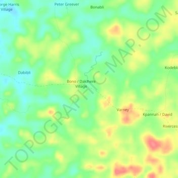
Name: David topographic map, elevation, terrain.
Location: David, District # 1, Grand Bassa County, Liberia (6.34287 -10.25535 6.38287 -10.21535)
Average elevation: 87 m
Minimum elevation: 58 m
Maximum elevation: 127 m
Other topographic maps
Click on a map to view its topography, its elevation and its terrain.
Yeah
Liberia > Grand Bassa County > District # 1
Yeah, District # 1, Grand Bassa County, Liberia
Average elevation: 96 m