
Thank you for supporting this site ❤️
Make a donation
Make a donation
Gear up for your next adventure:
As an Amazon Associate, this site earns from qualifying purchases at no extra cost to you.
Rohai topographic map
Click on the map to display elevation.
Thank you for supporting this site ❤️
Make a donation
Make a donation
Gear up for your next adventure:
As an Amazon Associate, this site earns from qualifying purchases at no extra cost to you.
About this map
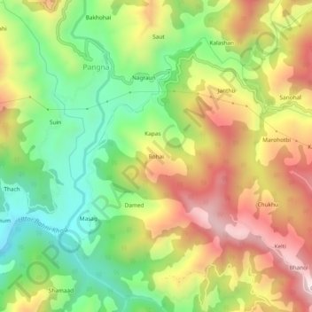
Name: Rohai topographic map, elevation, terrain.
Location: Rohai, Pangna, Karsog, Mandi, Himachal Pradesh, 175046, India (31.35403 77.11245 31.39403 77.15245)
Average elevation: 1,619 m
Minimum elevation: 1,316 m
Maximum elevation: 1,975 m
Thank you for supporting this site ❤️
Make a donation
Make a donation
Gear up for your next adventure:
As an Amazon Associate, this site earns from qualifying purchases at no extra cost to you.