
Rivière-des-Prairies–Pointe-aux-Trembles topographic map
Interactive map
Click on the map to display elevation.
About this map
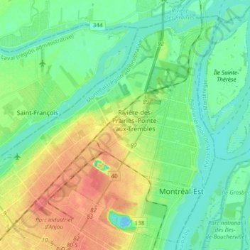
Name: Rivière-des-Prairies–Pointe-aux-Trembles topographic map, elevation, terrain.
Average elevation: 19 m
Minimum elevation: -8 m
Maximum elevation: 54 m
Other topographic maps
Click on a map to view its topography, its elevation and its terrain.
Ville-Marie
Ville-Marie, Montreal, Agglomération de Montréal, Montréal (06), Québec, Kanada
Average elevation: 30 m
Sankt-Lorenz-Strom
Sankt-Lorenz-Strom, Rue De Gaspé, Verdun, Montreal, Agglomération de Montréal, Montréal (06), Québec, H3E 1H2, Kanada
Average elevation: 14 m