
La Chorrera topographic map
Interactive map
Click on the map to display elevation.
About this map
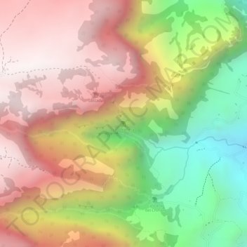
Name: La Chorrera topographic map, elevation, terrain.
Location: La Chorrera, Choachí, Oriente, Cundinamarca, Colombia (4.59724 -73.95982 4.59734 -73.95972)
Average elevation: 2,797 m
Minimum elevation: 2,235 m
Maximum elevation: 3,205 m