
Ratanakiri topographic map
Interactive map
Click on the map to display elevation.
About this map
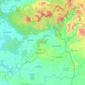
Name: Ratanakiri topographic map, elevation, terrain.
Location: Ratanakiri, Cambodia (13.17216 106.53019 14.69042 107.62768)
Average elevation: 271 m
Minimum elevation: 53 m
Maximum elevation: 1,715 m
Other topographic maps
Click on a map to view its topography, its elevation and its terrain.