
Leuvenheim topographic map
Interactive map
Click on the map to display elevation.
About this map
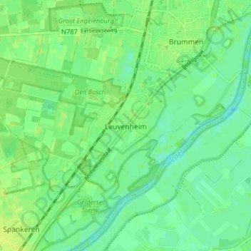
Name: Leuvenheim topographic map, elevation, terrain.
Location: Leuvenheim, Brummen, Gelderland, Netherlands (52.05918 6.09808 52.08893 6.16280)
Average elevation: 10 m
Minimum elevation: 2 m
Maximum elevation: 17 m