Columbus topographic map
Click on the map to display elevation.
Columbus
The confluence of the Scioto and Olentangy rivers is just north-west of Downtown Columbus. Several smaller tributaries course through the Columbus metropolitan area, including Alum Creek, Big Walnut Creek, and Darby Creek. Columbus is considered to have relatively flat topography thanks to a large glacier that covered most of Ohio during the Wisconsin Ice Age. However, there are sizable differences in elevation through the area, with the high point of Franklin County being 1,132 ft (345 m) above sea level near New Albany, and the low point being 670 ft (200 m) where the Scioto River leaves the county near Lockbourne. Numerous ravines near the rivers and creeks also add variety to the landscape. Tributaries to Alum Creek and the Olentangy River cut through shale, while tributaries to the Scioto River cut through limestone.
About this map
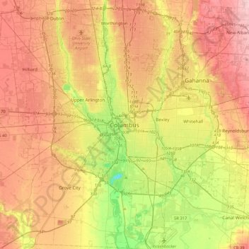
Name: Columbus topographic map, elevation, terrain.
Location: Columbus, Franklin County, Ohio, 43216, United States (39.80226 -83.16071 40.12226 -82.84071)
Average elevation: 255 m
Minimum elevation: 169 m
Maximum elevation: 333 m
Other topographic maps
Click on a map to view its topography, its elevation and its terrain.