
Beuningen topographic map
Interactive map
Click on the map to display elevation.
About this map
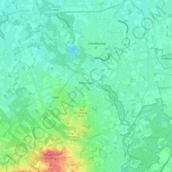
Name: Beuningen topographic map, elevation, terrain.
Location: Beuningen, Losser, Overijssel, Nederland (52.33563 6.96110 52.37986 7.07276)
Average elevation: 32 m
Minimum elevation: 16 m
Maximum elevation: 81 m