
Yèntar topographic map
Interactive map
Click on the map to display elevation.
About this map
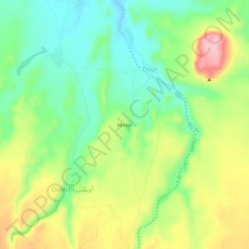
Name: Yèntar topographic map, elevation, terrain.
Location: Yèntar, Doui, Tibesti, Chad (21.14667 17.41333 21.18667 17.45333)
Average elevation: 1,338 m
Minimum elevation: 1,271 m
Maximum elevation: 1,438 m