Geolocate

Rodna topographic map

Click on the map to display elevation.

About this map

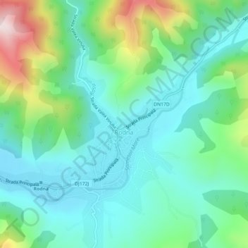
Name: Rodna topographic map, elevation, terrain.

Location: Rodna, Bistrița-Năsăud, 427245, Romania (47.41237 24.78992 47.43567 24.83469)

Average elevation: 634 m

Minimum elevation: 503 m

Maximum elevation: 1,019 m

Gear up for your next adventure:

🌦️Portable Weather Meters - Handheld tools for monitoring weather conditions
🧼Biodegradable Soap - Leave-no-trace hygiene for multi-day mountain treks
📷Camera Straps - Secure straps for carrying cameras while walking
🛌Sleeping Bags - Warm and packable sleeping bags for outdoor nights
📢Survival Whistles - Essential safety gear for signaling for help in mountain fog

As an Amazon Associate, this site earns from qualifying purchases at no extra cost to you.