
Nizhny Tagil topographic map
Interactive map
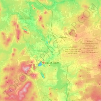
Click on the map to display elevation.
About this map
Name: Nizhny Tagil topographic map, elevation, terrain.
Average elevation: 234 m
Minimum elevation: 121 m
Maximum elevation: 377 m
Rivers and ponds take up one third of the city's territory. Nizhny Tagil spans 22 kilometers (14 mi) from north to south and 21 kilometers (13 mi) from east to west. The altitude of the city varies from 170 to 380 meters (560 to 1,250 ft).
Other topographic maps
Click on a map to view its topography, its elevation and its terrain.
Тагил
Russia > Sverdlovsk Oblast > городской округ Нижний Тагил > Nizhny Tagil
Тагил, Выя, Ленинский район, Nizhny Tagil, городской округ Нижний Тагил, Sverdlovsk Oblast, Ural Federal District, 622001, Russia
Average elevation: 203 m