
Montgó topographic map
Interactive map
Click on the map to display elevation.
About this map
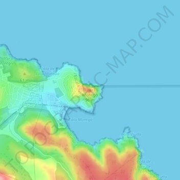
Name: Montgó topographic map, elevation, terrain.
Average elevation: 17 m
Minimum elevation: -1 m
Maximum elevation: 109 m
Der Montgó (seltener auch Mongó) ist ein Berg im Südosten Spaniens, im Norden der Costa Blanca, in der Nähe der Küstenstädte Dénia und Xàbia mit einer Höhe von 753 msnm. Der Montgó selbst und das ihn umgebende Gebiet ist Naturschutzgebiet („Parc Natural el Montgó“).