
Rioaveso topographic map
Interactive map
Click on the map to display elevation.
About this map
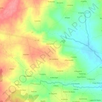
Name: Rioaveso topographic map, elevation, terrain.
Location: Rioaveso, Vilalba, Tierra Chá, Lugo, Galicia, España (43.26588 -7.63513 43.29346 -7.57579)
Average elevation: 444 m
Minimum elevation: 401 m
Maximum elevation: 491 m
Other topographic maps
Click on a map to view its topography, its elevation and its terrain.