
Wardenburg topographic map
Interactive map
Click on the map to display elevation.
About this map
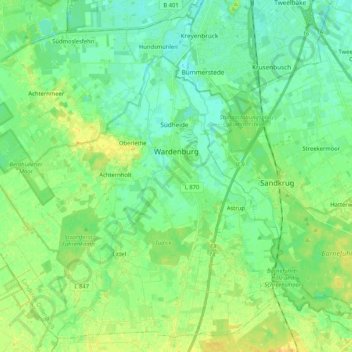
Name: Wardenburg topographic map, elevation, terrain.
Location: Wardenburg, Landkreis Oldenburg, Nedersaksen, 26203, Duitsland (52.99899 8.05100 53.11413 8.25900)
Average elevation: 10 m
Minimum elevation: 1 m
Maximum elevation: 26 m