Geolocate

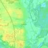
Meinersen topographic map

Click on the map to display elevation.

About this map

Name: Meinersen topographic map, elevation, terrain.

Location: Meinersen, Samtgemeinde Meinersen, Landkreis Gifhorn, Niedersachsen, 38536, Deutschland (52.43041 10.25836 52.52805 10.40096)

Average elevation: 54 m

Minimum elevation: 45 m

Maximum elevation: 86 m

Other topographic maps

Click on a map to view its topography, its elevation and its terrain.
Gamsen

Deutschland > Niedersachsen > Landkreis Gifhorn > Gifhorn

Average elevation: 60 m

Gear up for your next adventure:

🛌Insulated Sleeping Mats - Crucial thermal protection when sleeping on cold, uneven ground
🧣Neck Gaiters - Protects against wind and sun on exposed ridges and peaks
🚲Cycling GPS Computers - Track elevation and topographic routes on two wheels
🕶️Polarized Sunglasses - Reduces glare from snow and water when reading terrain
📸Action Camera Chest Mounts - Record your ascent following topographic paths hands-free

As an Amazon Associate, this site earns from qualifying purchases at no extra cost to you.