
Lira topographic map
Interactive map
Click on the map to display elevation.
About this map
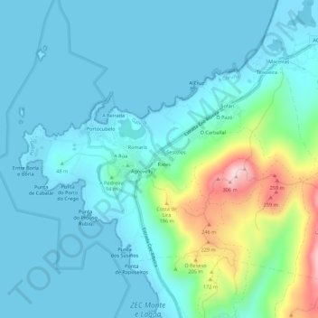
Name: Lira topographic map, elevation, terrain.
Location: Lira, Carnota, Muros, Galicia, 15292, España (42.77904 -9.14699 42.81904 -9.10699)
Average elevation: 53 m
Minimum elevation: -1 m
Maximum elevation: 306 m