Geolocate

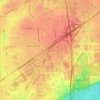
Lockport topographic map

Click on the map to display elevation.

About this map

Name: Lockport topographic map, elevation, terrain.

Location: Lockport, Will County, Illinois, 60441, United States (41.55610 -88.07589 41.64158 -87.96348)

Average elevation: 198 m

Minimum elevation: 143 m

Maximum elevation: 242 m

Other topographic maps

Click on a map to view its topography, its elevation and its terrain.

Drummond

United States > Illinois > Will County

Average elevation: 167 m

Marley

United States > Illinois > Will County

Average elevation: 214 m

Puddle Pond

United States > Illinois > Will County > Plainfield

Average elevation: 187 m

Arbury Hills

United States > Illinois > Will County

Average elevation: 216 m

Gear up for your next adventure:

🎒Multi-day Trekking Packs - Large capacity backpacks for wild camping and long-distance trails
🥄Titanium Camping Sporks - The ultimate lightweight utensil for trail meals
📢Survival Whistles - Essential safety gear for signaling for help in mountain fog
📦Dry Bags - Waterproof bags to protect gear from rain
🥾Men's Waterproof Hiking Boots - Durable footwear with deep lugs for muddy and rocky UK terrains

As an Amazon Associate, this site earns from qualifying purchases at no extra cost to you.