Geolocate

Soledad topographic map

Click on the map to display elevation.

About this map

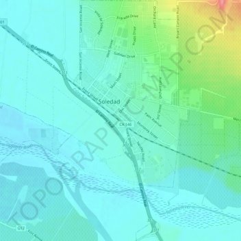
Name: Soledad topographic map, elevation, terrain.

Location: Soledad, Monterey County, California, 93960, United States (36.40167 -121.33527 36.44520 -121.30671)

Average elevation: 64 m

Minimum elevation: 46 m

Maximum elevation: 138 m

Gear up for your next adventure:

📚UK Hiking Guidebooks - Detailed route descriptions for the Lake District, Peaks, and Highlands
👕Merino Base Layers - Natural temperature regulation for cold weather hiking and camping
🥾Men's Waterproof Hiking Boots - Durable footwear with deep lugs for muddy and rocky UK terrains
🧢Waterproof Hiking Hats - Keep the rain off your face while studying topographic maps
👟Heavy Duty Boot Laces - Always carry a spare for your hiking footwear

As an Amazon Associate, this site earns from qualifying purchases at no extra cost to you.