
Častá topographic map
Interactive map
Click on the map to display elevation.
About this map
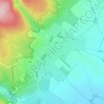
Name: Častá topographic map, elevation, terrain.
Average elevation: 262 m
Minimum elevation: 193 m
Maximum elevation: 445 m
The village lies at an altitude of 245 meters and covers an area of 35.24 km². It has population of 2,078 people.
Other topographic maps
Click on a map to view its topography, its elevation and its terrain.
Vištuk
Slovakia > Region of Bratislava > District of Pezinok
Vištuk, District of Pezinok, Region of Bratislava, 900 85, Slovakia
Average elevation: 185 m
Pezinok
Slovakia > Region of Bratislava > District of Pezinok
Pezinok, District of Pezinok, Region of Bratislava, Slovakia
Average elevation: 300 m
Štefanová
Slovakia > Region of Bratislava > District of Pezinok
Štefanová, District of Pezinok, Region of Bratislava, Slovakia
Average elevation: 210 m