
Faido topographic map
Interactive map
Click on the map to display elevation.
About this map
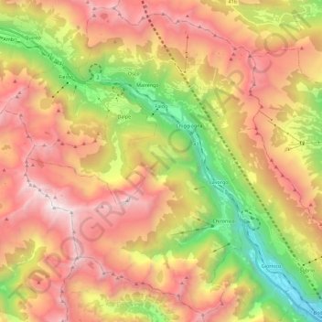
Name: Faido topographic map, elevation, terrain.
Location: Faido, Circolo di Faido, Bezirk Leventina, Tessin, Schweiz (46.37839 8.70626 46.52518 8.92909)
Average elevation: 1,713 m
Minimum elevation: 324 m
Maximum elevation: 3,036 m
Other topographic maps
Click on a map to view its topography, its elevation and its terrain.
Chiggiogna
Schweiz > Tessin > Bezirk Leventina
Chiggiogna, Faido, Circolo di Faido, Bezirk Leventina, Tessin, 6764, Schweiz
Average elevation: 1,158 m