
Libernon topographic map
Interactive map
Click on the map to display elevation.
About this map
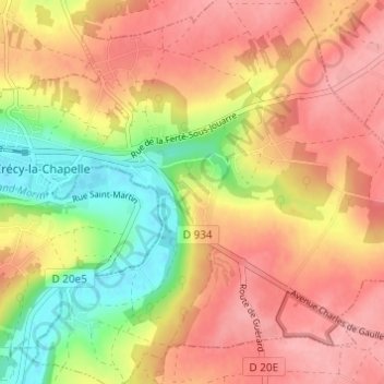
Name: Libernon topographic map, elevation, terrain.
Average elevation: 112 m
Minimum elevation: 48 m
Maximum elevation: 155 m
Other topographic maps
Click on a map to view its topography, its elevation and its terrain.
Montbarbin
France > Île-de-France > Seine-et-Marne > Crécy-la-Chapelle
Montbarbin, Crécy-la-Chapelle, Meaux, Seine-et-Marne, Île-de-France, France métropolitaine, 77580, France
Average elevation: 92 m