
Le Fays topographic map
Interactive map
Click on the map to display elevation.
About this map
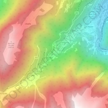
Name: Le Fays topographic map, elevation, terrain.
Location: Le Fays, Martigny-Combe, Martigny, Valais, 1921, Suisse (46.05256 7.00952 46.09256 7.04952)
Average elevation: 1,402 m
Minimum elevation: 488 m
Maximum elevation: 2,216 m