
Thank you for supporting this site ❤️
Make a donation
Make a donation
Gear up for your next adventure:
As an Amazon Associate, this site earns from qualifying purchases at no extra cost to you.
Siakago topographic map
Click on the map to display elevation.
Thank you for supporting this site ❤️
Make a donation
Make a donation
Gear up for your next adventure:
As an Amazon Associate, this site earns from qualifying purchases at no extra cost to you.
About this map
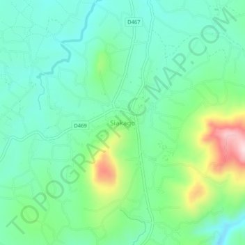
Name: Siakago topographic map, elevation, terrain.
Location: Siakago, Mbeere North, Embu, Eastern, Kenya (-0.59952 37.61965 -0.55952 37.65965)
Average elevation: 1,201 m
Minimum elevation: 1,107 m
Maximum elevation: 1,450 m
Thank you for supporting this site ❤️
Make a donation
Make a donation
Gear up for your next adventure:
As an Amazon Associate, this site earns from qualifying purchases at no extra cost to you.