
Santo Tomé del Puerto topographic map
Interactive map
Click on the map to display elevation.
About this map
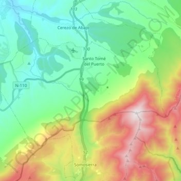
Name: Santo Tomé del Puerto topographic map, elevation, terrain.
Location: Santo Tomé del Puerto, Riaza, Castilië en León, 40590, Spanje (41.14270 -3.66375 41.21485 -3.51588)
Average elevation: 1,347 m
Minimum elevation: 975 m
Maximum elevation: 2,124 m