Geolocate

Kittur topographic map

Click on the map to display elevation.

About this map

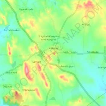
Name: Kittur topographic map, elevation, terrain.

Location: Kittur, Kitturu taluku, Karnataka, 591115, India (15.55933 74.74789 15.63933 74.82789)

Average elevation: 724 m

Minimum elevation: 682 m

Maximum elevation: 801 m

Gear up for your next adventure:

📚UK Hiking Guidebooks - Detailed route descriptions for the Lake District, Peaks, and Highlands
🥾Trekking Poles - Poles to improve stability on uneven terrain
🍱Food Containers - Reusable containers for outdoor meals
🦶Anti-Blister Balms - Protect your feet before long topographic expeditions
🔋Lithium AA Batteries - Long-lasting power that performs well in cold mountain weather

As an Amazon Associate, this site earns from qualifying purchases at no extra cost to you.